THE STORY
Contents
- Reykjadalur, Iceland: The Boiling River on a Thin Stone Lid, Hot-Spring Birds, and the Face Mask Made of Rust
- Climbing the Ptarmigan Luge Track into an Extinct Volcano's Roots
- Invisible Ropes in Klambragil, Living Colour, and the Rust Face-Mask Comedy
- Blind Ingólfur, the Cannibal Giantess of Jórukleif, and the Birds Cooked in Ice Water
- Why the Pine Boardwalk Is There: The February 2017 Crust Collapse
- Quick Facts: Reykjadalur Hot Spring River & The Grensdalur System
- Frequently Asked Questions (FAQ)
- Related Iceland Explained Episodes
Reykjadalur, Iceland: The Boiling River on a Thin Stone Lid, Hot-Spring Birds, and the Face Mask Made of Rust
Stop on the wooden footbridge in the upper basin of Reykjadalur, three kilometers uphill from the greenhouse town of Hveragerði in South Iceland, and pay attention to what your ribs are doing. You are not standing on a solid mountain hillside; you are standing on a lid. Beneath your boots, fractures in the deeply eroded Grensdalur volcanic terrain carry groundwater heated far below the surface. Before you even reach the warm bathing river, you breathe its exhaust: shifting waves of hydrogen sulfide drift across the heather: strong with rotten-egg sulfur for ten paces, gone on the next gust of highland wind, and back again with a sharp, metallic note of wet iron that condenses in warm, salty beads on your eyelashes.
Hotel brochures and Golden Circle tour operators translate Reykjadalur as "Steam Valley" and market the hike as a pastoral Nordic wilderness spa, where visitors stroll up a green valley, float in a naturally heated lazy river, and dab rejuvenating mineral mud on their cheeks. Once you look at the acid chemistry chewing through the bedrock, the medieval folklore that warned shepherds away from the vents, and what happened when a bather stepped onto apparently firm ground beside the river in February 2017, the lazy-river brochure disappears into the steam.
Climbing the Ptarmigan Luge Track into an Extinct Volcano's Roots
To reach the water, you first have to climb out of the lowlands. From the trailhead at Dalafell, where the steaming waters of Reykjadalur and its quiet eastern sister valley, Grændalur, join to form the river Varmá, the trail pitches steeply up the switchbacks of Rjúpnabrekkur, the "Ptarmigan Slopes." Right away, the sound under your boot soles changes from a dull crunch to a dry, brittle ticking. The ridge is built of yellowish-brown palagonite tuff (móberg) and hyaloclastite breccia: Pleistocene basaltic magma that erupted beneath a thick Ice Age glacier and flash-quenched on contact with meltwater into shards of hydrated volcanic glass.
To your left, the canyon of Djúpagil slices open that subglacial history like a geological layer cake, where the white water of Djúpagilsfoss drops twenty meters past stacked columns of dark Holocene basalt and ochre tuff. In July, hardy rock ptarmigans (rjúpa) nest in the heather tussocks in mottled brown camouflage while common snipes (hrossagaukur) dive through the evening air, vibrating their outer tail feathers in a resonant winnowing drum. Walk up those same Rjúpnabrekkur switchbacks in January without steel microspikes (broddar) strapped to your boots, and you discover why local search-and-rescue teams dread sunny winter Saturdays: compacted snow and freezing steam turn the steep palagonite trail into an inclined chute of blue glare ice that introduces smooth-soled city sneakers to volcanic gravel at high speed.
Crest the ridge into the upper valley, and the geology opens into a live chemical digestion vat. Reykjadalur is cut into the eastern margin of the Hengill triple junction, where the North American and Eurasian plates pull apart at roughly two centimeters a year. While the active central volcano of Hengill rises to the west, this valley sits directly inside the gutted core of the older Grensdalur central volcano, which was active roughly 120,000 years ago before plate drift carried it east and glaciers planed off its summit, exposing pale pink and yellow outcrops of silica-rich rhyolite (>69% SiO2) along the upper walls.
As superheated water rises along fault fractures and flashes to steam, escaping hydrogen sulfide gas (H2S) reacts with oxygen and shallow groundwater to form sulfuric acid (H2SO4). That acid attacks solid black basalt and pale rhyolite from below, dissolving the hard rock into a boiling, grey-white porridge of kaolinite clay. Stand beside the large mud cauldron near the footbridge, and you can tell the recent weather by the pitch of its voice: after a dry week, the thickened grey clay traps gas pockets until they burst with a slow, hollow bass thud you feel in your chest; after heavy rain, the diluted slurry splatters like hot bacon grease. And on May 29, 2008, a magnitude 6.3 strike-slip earthquake struck Ölfus, a reminder that the stone lid belongs to a landscape threaded with active faults.
Invisible Ropes in Klambragil, Living Colour, and the Rust Face-Mask Comedy
Follow the rough pine boardwalk to the upper bathing reach below the gully of Klambragil ("Pinch Gorge"), step out of the subarctic wind behind one of the unroofed X-shaped timber screens, and lower yourself onto the rounded riverbed cobbles of the Reykjadalsá.
The first surprise is that the river refuses to mix politely. Down from the highland moors comes a brisk, cold mountain stream; out of the narrow rock vice of Klambragil pour boiling alkaline hot springs at ninety to one hundred degrees Celsius alongside rare carbonic soda springs (kolsýruhverir). Low stone weirs stacked across the channel slow the water just enough to hold the average bath between thirty-six and forty degrees Celsius, while dissolved minerals travel out of deep rock into the cooling current. Yet within that water, incomplete mixing twists the two inflows into invisible ropes: lie back on the slippery stones and your left hand can go numb in a thread of highland snowmelt while your right hand tingles in a vein of scalding spring water.
Look at the shallow runoff channels and wet clay banks beside your elbow, and you are looking at a geothermal ecosystem with a remarkable range of microscopic life. Where hot water spills over the sinter stones, heat-loving bacteria and archaea paint the rock in microbial mats whose communities change with temperature and water chemistry. Yellow, green, and orange-brown growth can turn a runoff channel into a living colour chart, but its colours cannot identify a species or tell you whether the water is safe to touch. Along the warm, damp turf margins, where geothermal heat keeps the soil frost-free through January, grow two of Iceland's rarest Red-Listed vascular plants: Blue Water-speedwell (Veronica anagallis-aquatica, laugadepla) in the warm shallows, and the tiny, primitive spore-bearing fern called Small Adder's-tongue (Ophioglossum azoricum, naðurtunga).
Then there is the bright, oxblood-red mud lining the water's edge. In summer, some bathers scoop up handfuls of that sticky crimson paste and smear it across their cheeks and foreheads for a photograph, convinced they have stumbled onto a free wilderness version of the Blue Lagoon's silica skin mask. The red staining points to iron oxides, wet volcanic rust, rather than a tested skin treatment. The chemistry of geothermal habitats, and the microbes that live in them, gives astrobiologists clues about how life might leave traces on other planets. Fascinating for planetary science; a rather thin basis for an anti-aging cream.
Blind Ingólfur, the Cannibal Giantess of Jórukleif, and the Birds Cooked in Ice Water
Humans have been negotiating with this steaming valley since the very first generation of Norse settlement, and for the first ten centuries nobody came up here to work on their complexion. According to Landnámabók (the Book of Settlements), Iceland's first permanent settler, Ingólfur Arnarson, whose flat-topped mountain, Ingólfsfjall, guards the eastern side of the valley mouth, spent the final years of his life old and blind at the farmstead of Reykir í Ölfusi, directly at the foot of the Reykjadalur hills.
For the sheep farmers who followed Ingólfur, Reykjadalur was a high-stakes winter larder. Because subterranean heat kept the turf along the Reykjadalsá snow-free and green weeks earlier in spring and months later into autumn than the frozen heaths around it, shepherds drove their flocks into the valley for out-of-season grazing. That free grass came with a dangerous neighbour: warm turf could lead a grazing ewe toward thin clay skins and boiling vents. The pasture and the boiler occupied the same hillside.
To make sure shepherds and travelers never forgot how quickly these mountains could turn lethal when the steam and highland fog rolled in, local folklore populated the passes with monsters and inverted physics. Just north of the valley system, in the jagged fault cleft of Jórukleif above Þingvallavatn, across the same raw Hengill ridges where HBO's Game of Thrones later filmed the cliffside brawl between Brienne of Tarth and the Hound, lived the cannibal giantess Jóra. In the folk tales collected by Jón Árnason, she began life as Jórunn, a farmer's daughter in Sandvíkurhreppur in Flói. Watching her father's horse lose a horse fight, she flew into a rage, tore a thigh from the rival animal, and fled with it. She hurled a boulder into the Ölfusá to cross the river, reached Hengill, and settled in a cave, becoming a monstrous troll-wife who leaped out of the mountain mist to butcher travelers and horses, until a young man armed with a silver-inlaid axe from the King of Norway caught her sleeping face-down at sunrise on Whitsun morning and drove the blade between her shoulders, sending the axe head drifting down into the river Öxará at Þingvellir.
Even closer to the boiling vents of Reykjadalur and the neighboring ridge of Ölkelduháls, locals told the story of the hverafuglar: the hot-spring birds. Described as small, dark-feathered birds, the hverafuglar were said to swim calmly inside violently boiling cauldrons. According to the tale, if a hungry traveler managed to catch one and dropped it into a pot of boiling water over a fire, the meat stayed completely raw; the only way to cook a hot-spring bird was to plunge it into ice-cold water. In a valley where green grass hides scalding water and rivers run warm in January blizzards, even the cookbook had to be turned upside down.
Why the Pine Boardwalk Is There: The February 2017 Crust Collapse
The rough wooden boardwalks and numbered emergency stakes have two urgent jobs: to keep boots on the route through fragile vegetation, and to help keep human legs out of the boiler underneath. Landvernd coordinated the valley's nature and safety panels with local partners, putting the same warning into words beside the trail.
On a winter afternoon in February 2017 (archival source; link unavailable), twenty-four-year-old Canadian visitor Nicole Rakowski hiked up to Reykjadalur with friends, changed into her swimsuit by the river, and stepped onto ground she thought was firm beside the bathing river.
The mineral crust snapped instantly under her weight. Her leg plunged knee-deep into a hidden boiling vent: a sensation she described as being stabbed by a million knives at once. Her friends hauled her out, and she described skin peeling from her scalded leg before she lost consciousness from the pain. Up on the floor of the thermal basin, there was no road for an ambulance and zero mobile phone reception. Four men, including Californian paramedic Lee Ricasa, carried her downhill toward the rescuers while a friend ran ahead seeking phone reception. On the way down, the group encountered an Icelander training for rescue work who had a radio and called for further help.
Settle back down between the rounded basalt cobbles of the Reykjadalsá as the steam drifts across the water and beads on your eyelashes, and listen to the valley around you. Fifty meters away, the grey kaolinite mud pots thump through the stone floor against your shoulder blades; beside your elbow, the pine boardwalk marks the thin line between a forty-degree soak and a scalding vent. A ribbon of cold highland snowmelt slips past your left hand, a vein of volcanic heat wraps around your right, and the mountain keeps digesting itself underneath the stones.
A STORY. NOT A GUIDE.
ICELAND. TOLD.
Quick Facts: Reykjadalur Hot Spring River & The Grensdalur System
| Feature / Attribute | Field Detail (source key: Field Notes) |
|---|---|
| Location & Trail Scale | Sveitarfélagið Ölfus (trailhead at Dalafell, 3 km north of Hveragerði, South Iceland); 3.0–3.5 km one-way hike (~45–60 min ascent up Rjúpnabrekkur to 64.0219, -21.2106 at ~245 m a.s.l.) [S1, S3]. |
| Volcanic & Tectonic Engine | Cut into eroded Grensdalur volcanic terrain at the eastern margin of the Hengill area; the official panel describes volcanic activity roughly 120,000 years ago. The May 29, 2008 Mw 6.3 earthquake struck the wider Ölfus region [S3, S6, S10]. |
| Bathing River Mechanics | The Reykjadalsá blends cold highland snowmelt with 90–100°C alkaline silica springs and carbonic soda springs (kolsýruhverir) from Klambragil behind low stone weirs to maintain 36–40°C bathing pools [S3, S9]. |
| Biology & Red-List Flora | Varied geothermal bacteria and archaea; microbial mats whose colours do not provide a reliable temperature scale; nationally protected Small Adder's-tongue fern (Ophioglossum azoricum / naðurtunga) and Blue Water-speedwell (Veronica anagallis-aquatica / laugadepla) [S3, S12]. |
| History & Folklore | Final home of blind first settler Ingólfur Arnarson at Reykir í Ölfusi (Landnámabók); winter sheep grazing hazard; folklore of the cannibal giantess Jóra of Jórukleif and the hverafuglar ("hot-spring birds" cooked only in ice water) [S3, S7]. |
| Primary Field Hazards | Never step off the pine boardwalks: thin mud crusts conceal 90–100°C vents (site of the Feb 2017 third-degree burn rescue (archival source; link unavailable)); Rjúpnabrekkur switchbacks turn into blue glare ice in winter (pack steel microspikes / broddar); patchy/zero cell signal in the basin. |
Frequently Asked Questions (FAQ)
Is the red mud on the riverbanks of Reykjadalur a healthy geothermal skin mask?
It should not be treated as a tested skincare product. Iron oxides can stain geothermal clay red, but colour alone does not establish its exact mineral or microbial composition. Leave the banks undisturbed: fragile crusts can conceal scalding water or mud.
How long is the hike to the Reykjadalur hot spring river, and can you visit in winter?
The hike from the Dalafell trailhead north of Hveragerði to the Klambragil bathing pools is roughly 3 to 3.5 kilometers one way (6–7 km round trip), climbing about 165 meters up the steep switchbacks of Rjúpnabrekkur past Djúpagilsfoss waterfall. Access depends on conditions and closures; check SafeTravel before setting out. In winter, the steep switchbacks can freeze into glare ice, requiring suitable traction, waterproof boots, and windproof layers; turn back when conditions are unsafe.
Why does the water temperature in Reykjadalur change from spot to spot inside the river?
The river is not a single uniform hot spring; it is a live mixing zone where a cold highland meltwater stream meets 90–100°C geothermal water pouring out of the Klambragil gully. Low stone weirs help blend the two currents between 36°C and 40°C, but upper pools closer to the Klambragil inflows are significantly hotter, and distinct warm and cold ribbons flow side by side along the riverbed.
What are the hverafuglar ("hot-spring birds") of Reykjadalur?
In local Ölfus folklore preserved on the valley's heritage signs, the hverafuglar were small, dark-feathered birds that swam unharmed inside violently boiling cauldrons around Reykjadalur and Ölkelduháls. According to the legend, if you caught one and tried to boil it in a cooking pot, the meat stayed raw; it could only be cooked by plunging it into ice-cold water.
Related Iceland Explained Episodes
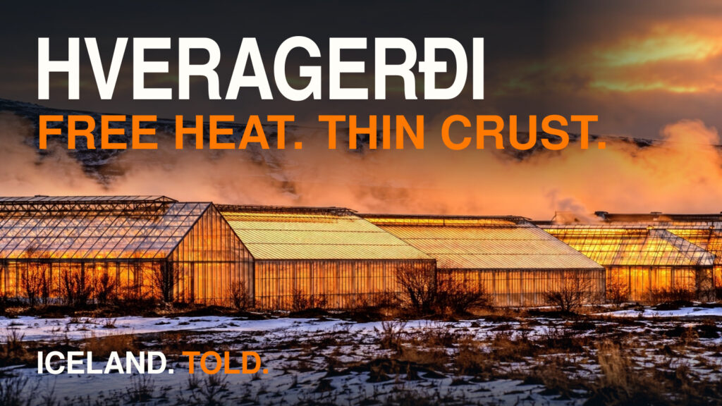
- Hveragerði, Iceland | Steam Town, Greenhouses & the 2008 Earthquake (EP_12): Follow the Reykjadalsá three kilometers downstream into Hveragerði, where the river becomes the Varmá and geothermal energy heats greenhouses.
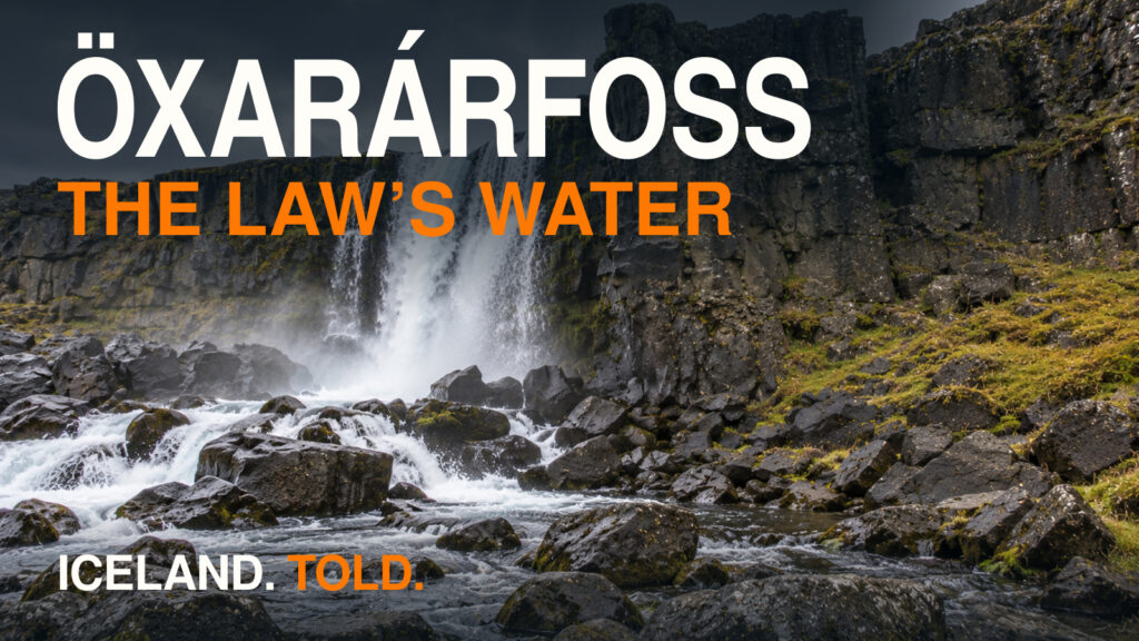
- Öxarárfoss & Drekkingarhylur | Dark History in Þingvellir (EP_18): Follow the silver-inlaid axe that killed the giantess Jóra of Jórukleif down into the river Öxará at Þingvellir.
- Selfoss, Iceland | The Suspension-Bridge Town on a Fault (EP_16): Trace the May 29, 2008 strike-slip earthquake fault from the mouth of Reykjadalur across the Ölfus plain to Selfoss.