THE STORY
Contents
- Hveragerði, Iceland: The Garden Town Built on a Boiling Fault Line, Poets’ Mud Alley, and a Grandmother Named Clay
- How a Fatal Step in 1906 Lit Rural Iceland, and How Live Steam Built the First Skyr Factory
- Mud Alley, a Shared Fifty-Foot Borehole, and the Poets of Skáldagata
- Why the Earth Threw Back the Rubbish in 1947, and Named a Mud Pot Clay-Gerður in 2008
- Reading the Bacterial Thermometer and the Crust of the Sinking Man
- Quick Facts: Hveragerði & The Hengill-Grensdalur Geothermal System
- Frequently Asked Questions (FAQ)
- Related Iceland Explained Episodes
Hveragerði, Iceland: The Garden Town Built on a Boiling Fault Line, Poets’ Mud Alley, and a Grandmother Named Clay
Step out of a car in the center of Hveragerði, forty-five kilometers east of Reykjavík at the foot of the Hellisheiði mountain pass, and your molars register the town before your eyes do. Across the enclosed sinter basin of Hveragarðurinn and along the banks of the river Varmá, high-pressure steam vents through steel borehole pipes and fractured basalt with a continuous industrial hiss. Underneath that white noise sits a much lower frequency: a rhythmic hydraulic thump that rises through the soles of your boots and settles into your ribcage as subterranean steam bubbles collapse against the rock column. Within seconds of walking through a drifting plume on the sidewalk, warm droplets of condensation gather on your eyelashes and leave a faint, metallic tang of copper and hydrogen sulfide on your lips.
To drivers speeding past on Route 1 toward the waterfalls of South Iceland, the municipality of Hveragerðisbær looks like a sheltered garden suburb: neat timber gables, windbreaks of Sitka spruce and downy birch, and fifty thousand square meters of glass nurseries tucked into a green lowland bowl. Yet the Icelandic place name, first recorded in the Fitjaannáll chronicle shortly before 1700, spells out the actual terms of the lease: hver means a boiling or erupting hot spring, and gerði means a fenced-in garden patch. Every fence post in this valley is driven into a thin, hydrothermally altered crust floating over the Hengill-Grensdalur volcanic system, where water one kilometer beneath the flowerbeds exceeds two hundred degrees Celsius, and where the stories the spoken episode had to compress reveal how a deadly moorland crossing turned itself into a sanctuary for banana growers, exiled novelists, and wartime schoolteachers.
How a Fatal Step in 1906 Lit Rural Iceland: and How Live Steam Built the First Skyr Factory
For the first thousand years of Icelandic history, nobody built a house in the steaming hollow below the cliff of Hamarinn. The hot-spring field belonged to the farmstead of Vorsabær in Ölfus, and travelers descending from the Hellisheiði heath treated the unlit footpath across the sinter flats with well-earned caution. Farm women walked out onto the crust by daylight to wash wool in alkaline pools and bury wooden boxes of dark rye dough (hverabrauð) in the ninety-eight-degree black sand of Brauðholur, returning twenty-four hours later to dig out sweet, dark loaves braised by the ground. Earthquakes rearranged that kitchen without notice; the Fitjaannáll chronicler noted that severe tremors in 1597 shut down familiar vents and threw up a new erupting geyser across the basin.
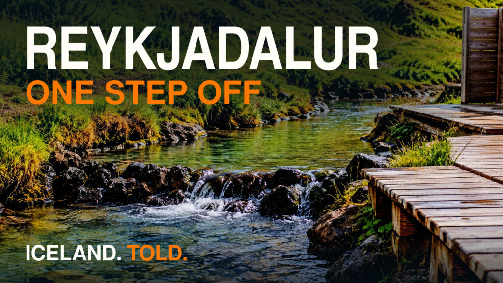
Modern Hveragerði began beside the water only because the river refused to freeze. Fed by cold snowmelt from the Hengill highlands and injected with boiling water from vents along Reykjadalur and Grændalur, the Varmá (“Warm River”) stays ice-free through the dead of winter, creating a year-round insect hatch that feeds oversized brown trout holding station in deep, cold-stratified pools below Reykjafoss. In 1902, entrepreneurs built a wool mill beside Reykjafoss specifically so its waterwheel could spin through January blizzards. Four years later, in 1906, a traveler walking the dark footpath across the central geothermal field lost his bearings in the thick sulfur fog, broke through into a boiling cauldron, and died of his burns. The vent has been known ever since as Manndrápshver: Man-Killer Spring.
Shaken by the death, the wool-mill operators mounted a small hydroelectric dynamo in the warm current at Reykjafoss and strung electric incandescent bulbs along the footpath past the boiling pits. Rural Iceland did not get its first electric street lighting to illuminate a town square or a merchant’s shopfront; it wired the river so travelers would not be cooked alive on their way across the mud.
Once the path was lit, engineers stopped merely dodging the steam and started piping it into galvanized iron. In the spring of 1929, former agricultural director Sigurður Sigurðsson and his son Ingimar erected Hveragerði’s first geothermal greenhouses at Fagrihvammur on the riverbank, while the village’s first permanent house, Varmahlíð, went up beside them. On April 1, 1930, the Mjólkurbú Ölfusinga dairy cooperative opened next to the new community hall (Þinghús, designed by State Architect Guðjón Samúelsson). Rather than burning imported coal to heat its vats, the dairy capped a vigorous vent in the thermal field called Bakkahver under a small pyramid-roofed stone housing and piped live volcanic steam straight into the building. That pipe pasteurized the milk of the Ölfus plain and powered Skyrgerðin: Iceland’s first industrial skyr dairy, which also produced the country’s first commercial yogurt under the name heilsumjólk.
By 1939, the state had founded the Horticultural School (Garðyrkjuskóli ríkisins, now part of the Agricultural University of Iceland) at Reykir on the hillside above town, and two years later the first dwarf Cavendish banana plants (Musa acuminata) were fruiting under geothermally heated glass. Internet trivia websites still love to repeat the urban myth that Iceland is Europe’s largest commercial exporter of bananas. Walk inside the tropical greenhouse at Reykir today and the reality is far more charming: cheap imported fruit after 1960 tariff cuts ended commercial banana sales decades ago, leaving the university’s six to seven hundred banana trees as a living subtropical classroom that harvests a metric ton of fruit each year for students and guests, while fifty thousand square meters of surrounding commercial glass stain the December clouds a bruised sodium-vapor orange.
Mud Alley, a Shared Fifty-Foot Borehole, and the Poets of Skáldagata
During the Second World War, when British and American occupation troops crowded into Reykjavík and sent urban rents soaring, Hveragerði’s cheap volcanic heat attracted a cohort of settlers who owned almost nothing except typewriters and paintbrushes. Between 1940 and 1965, they built modest timber cottages along the western edge of the hot-spring field, creating an unruly bohemian quarter known as Listamannahverfið (“The Artists’ Quarter”).
Their main lane was originally called Skáldagata (“Poets’ Street”) until resident Marxist essayist and municipal councilman Gunnar Benediktsson, who led the political campaign that separated Hveragerði from Ölfus as an independent municipality in 1946, renamed the street Frumskógar (“Jungles”) in honor of the lush greenhouse trees. Getting from Poets’ Street to the village cooperative shop was an athletic event. Before gravel roads bridged the thermal basin, families had to cross the central field along an unpaved track of warm, hydrothermally leached clay called Drullusund (“Mud Alley”). In his memoirs, Benediktsson recalled that taking his infant daughter into the village required a two-adult expedition in tall rubber boots: one parent carrying the baby through the drifting sulfur steam while the other wrestled the empty baby carriage out of the warm, sucking clay holes until they reached solid gravel on Hveramörk.
The roster on those muddy lanes read like a twentieth-century anthology of Icelandic art and letters. On neighboring Bláskógar lane, tall, grey-bearded painter Kristinn Pétursson arrived in the autumn of 1940 so crippled by rheumatoid arthritis that his fingers could barely close; by soaking his hands every morning in hot sulfurous clay pits, he recovered enough dexterity to work at his easel beside fellow resident bird-painter Höskuldur Björnsson. One street over on Skáldagata, fiery socialist poet and future parliamentarian Jóhannes úr Kötlum lived a few doors away from bestselling romantic novelist Kristmann Guðmundsson, who had returned to Iceland in late 1940 after Nazi Germany banned his books and froze his continental bank accounts.
In 1941, Kristmann and his next-door neighbor at Frumskógar 11, master woodcarver and sculptor Ríkarður Jónsson, pooled their scarce cash and hired drillers to sink a fifty-foot borehole right on their shared property boundary, splitting the live volcanic steam between their two houses. In Reykjavík newspapers, the literary left and right waged bitter ideological warfare; in Hveragerði, whenever Jóhannes and Kristmann crossed paths at the village telephone exchange, they dueled on the spot in rapid-fire, four-line rhyming verses (ferskeytlur), and once a year the writers and greenhouse workers danced until dawn together at the legendary Blómaböllin (“Flower Balls”) under garlands of geothermal roses.
Across the river at Hverabakkar (Breiðumörk 23), another quiet feat of geothermal improvisation kept twenty young women in school. From 1935 to 1955, educator Árný Filippusdóttir single-handedly built and ran a residential women’s domestic school (Húsmæðraskóli), keeping her students in classes and workshops from eight in the morning until midnight. When wartime inflation threatened to close the building, Árný financed the school by marching down to the hot springs to boil laundry and cook home-style meals for Allied soldiers stationed nearby. A decade after the war, on July 24, 1955, retired physician Jónas Kristjánsson turned that same combination of hot clay, sulfur steam, and fresh greenhouse vegetables into a national institution by opening the Heilsustofnun NLFÍ rehabilitation clinic on the edge of the field.
Why the Earth Threw Back the Rubbish in 1947: and Named a Mud Pot Clay-Gerður in 2008
Living atop the cooling Pleistocene central volcano of Grensdalur means accepting that the plumbing beneath your garden is never finished. As two-hundred-degree water rises along north-northeast fault planes and flashes to steam, escaping hydrogen sulfide gas oxidizes in shallow groundwater into sulfuric acid (H2SO4). That acid chews through solid black tholeiitic basalt from below, leaching out calcium and magnesium until the rock dissolves into a grey, bubbling paste of kaolinite clay and brittle silica sinter (SiO2).
Whenever the transform faults of the South Iceland Seismic Zone slip, that acid boiler rearranges the surface. For years in the early twentieth century, residents used a quiet, seemingly extinct sinkhole in the central field as a convenient household dump, tossing in empty tin cans, broken bottles, and kitchen scraps. During an earthquake in 1947, the pressure seal shifted underground; the dormant pit woke up, boiled over, and blasted years of accumulated garbage across the neighborhood, earning the permanent name Ruslahver: the Rubbish Geyser. During the June 2000 South Iceland earthquakes, a minor steam crack nearby similarly roared to life as the churning mud cauldron Dynkur.
Then came Thursday, May 29, 2008, at 3:45 p.m. Two parallel strike-slip faults snapped between Hveragerði and Selfoss at a combined moment magnitude of 6.3. Because the western fault ruptured barely two kilometers from Hveragerði’s streets, near-fault directivity slammed into the town with zero warning. Eleven strong-motion sensors of the ICEARRAY network stationed across Hveragerði recorded horizontal ground accelerations reaching 0.88 g. A preliminary study also reported visual evidence suggesting that vertical acceleration exceeded 1.0 g: enough to lift unsecured objects clear of the floor during the brief, violent shaking.
Down in the center of town, the shear fractured the impermeable silica caprock and drained several historic springs overnight. Up on the grassy hillside of Kambabrún above the Reykir horticultural campus, where sheep had been grazing minutes earlier, the turf ripped open into a roaring line of high-pressure fumaroles and boiling acid mud pots. Rather than panicking, the municipality of Hveragerði held a public naming competition. Townsfolk walked up the ruptured hillside, peered into the largest new pit of sloshing grey kaolinite mud, and christened her Leirgerður (“Clay-Gerður”), alongside new vents named Skjálfti (“The Tremor”), Hrifla, and Reykjamóri (“Smoky Ghost”). When a volcano moves into the pasture behind the school, you put it on the parish register.
Reading the Bacterial Thermometer and the Crust of the Sinking Man
Walk the hillside trail past Leirgerður toward the upland valleys of Reykjadalur and Grændalur, across the steaming lava crags where Swedish director Olle Hellbom filmed Astrid Lindgren’s The Brothers Lionheart in 1977, and the ground gives you one visual warning before it burns you. In the shallow runoff channels draining the vents, heat-loving microbes occupy different conditions: blue-green mats of cyanobacteria such as Mastigocladus laminosus contrast with the orange pigments of Chloroflexus bacteria and pale mineral deposits around the vents. Temperature helps shape these communities, but color alone cannot tell you how hot, or safe, the water is.
Against that living mosaic of hot ground, old families in Hveragerði told children that the cliff of Hamarinn and the steaming knolls belonged to the Huldufólk (the Hidden People) and the ghost Reykjamóri. Treating those stories as quaint fairy tales misses their practical function: they were oral caution tape strung across a brittle silica crust (hverahrúður) that can look identical to solid turf while roofing ninety-five-degree acid clay. Locals still recount the ordeal of the “Sinking Man,” who stepped off the beaten track near an old drill site onto what looked like ordinary grey moss and basalt gravel. The thin mineral skin snapped under his boot, plunging his leg knee-deep into boiling mud; because wet wool and denim hold scalding clay tight against the skin, he had to walk forty-five minutes back to town on a cooked leg, just as unprepared hikers stepping off the boardwalks in Reykjadalur continue to suffer severe third-degree burns today.
Stand by the loading bay of a greenhouse at three in the morning in December, when the cloud ceiling overhead glows bruised orange and the Varmá sends its white corridor of mist winding past the 1906 streetlamps, and the whole bargain of Hveragerði comes into focus. A delivery door slides open; heavy plastic strip curtains slap against a worker’s parka, and a wave of warm potting soil and crushed tomato leaves rolls out into the sulfur frost. Underneath your boots, the same low hydraulic thump vibrates through the asphalt into your molars: two hundred degrees of volcanic water still digesting the mountain, baking the rye bread, and heating the Poets’ Street borehole.
A STORY. NOT A GUIDE.
ICELAND. TOLD.
Quick Facts: Hveragerði & The Hengill-Grensdalur Geothermal System
| Feature / Attribute | Verified Field Detail |
|---|---|
| Location & Access | Hveragerði (Hveragerðisbær), South Iceland; 45 km east of Reykjavík along Route 1 at the base of the Hellisheiði pass (63.9992, -21.2067). |
| Volcanic & Tectonic Engine | Eastern margin of the Hengill triple junction directly atop the extinct Pleistocene central volcano of Grensdalur; reservoir temperatures exceed 200°C at 1,000 m depth. |
| The May 29, 2008 Earthquake | Mw 6.3 dual strike-slip rupture in the South Iceland Seismic Zone (15:45 UTC); recorded horizontal acceleration up to 0.88 g, with separate visual evidence suggesting vertical acceleration above 1.0 g in town, birthing the hillside mud pot Leirgerður. |
| Historic Milestones | 1902: Reykjafoss wool mill built on the non-freezing Varmá. 1906: Fatal burn at Manndrápshver sparks rural electric streetlamps. 1929: First greenhouses at Fagrihvammur. 1930: Bakkahver steam powers Iceland’s first industrial skyr dairy. 1955: Dr. Jónas Kristjánsson opens Heilsustofnun NLFÍ. |
| Cultural Enclave | Skáldagata / Frumskógar (Listamannahverfið, 1940–1965): home to Jóhannes úr Kötlum, Kristmann Guðmundsson, Gunnar Benediktsson, Ríkarður Jónsson, and Kristinn Pétursson; 1977 filming location for Astrid Lindgren’s The Brothers Lionheart. |
| Primary Field Hazard | Brittle silica sinter crust (hverahrúður) over 90–100°C sulfuric acid kaolinite clay; stay strictly on gravel paths and wooden boardwalks in Hveragarðurinn, Kambabrún, and Reykjadalur. |
Frequently Asked Questions (FAQ)
Is Iceland really Europe’s largest banana producer because of Hveragerði?
No: that is a persistent foreign trivia myth. While geothermal banana cultivation began in Hveragerði in 1941 and the Agricultural University of Iceland at Reykir still maintains roughly 600 to 700 dwarf Cavendish banana plants that produce around a metric ton of fruit per year for campus and educational use, commercial banana production ended after import tariffs were lifted in 1960, and Iceland has never exported bananas.
Why did new hot springs and mud pots suddenly open on the hillside above Hveragerði in 2008?
On May 29, 2008, a magnitude 6.3 strike-slip earthquake ruptured a fault two kilometers from Hveragerði with visual evidence suggesting vertical ground acceleration above 1.0 g. The shear cracked the impermeable silica-and-clay caprock sealing the Grensdalur geothermal reservoir, draining several old vents in the lower town while splitting open the hillside pasture of Kambabrún into a new line of boiling acid mud cauldrons that locals named Leirgerður (“Clay-Gerður”), Skjálfti, and Reykjamóri.
What do the different colors in Hveragerði’s hot-spring channels mean?
Some colors come from heat-loving microorganisms, including blue-green cyanobacteria such as Mastigocladus laminosus and orange-pigmented Chloroflexus bacteria; others come from mineral deposits. Temperature helps determine which organisms thrive, but a color is not a reliable temperature reading or a test of whether water is safe to touch.
Where can you see the historic Poets’ Street and geothermal bread baking in Hveragerði?
Geothermal dark rye bread (hverabrauð), braised for 24 hours in hot black sand (Brauðholur), can be seen and tasted at Hveragarðurinn (Hveramörk 13) in the center of town. A short walk west across the former Drullusund (“Mud Alley”) footpath leads to Frumskógar (formerly Skáldagata), where informational signs mark the homes of the 1940–1965 writers’ and artists’ colony.
Related Iceland Explained Episodes
- Reykjadalur Hot Spring River, Iceland | Hengill Geothermal Valley (coming later): Hike three kilometers up the Varmá gorge above Hveragerði to see how iron-eating bacteria and boiling bankside vents heat Iceland’s most famous thermal bathing river.
- Selfoss, Iceland | The Suspension-Bridge Town on a Fault: Follow the May 29, 2008 earthquake fault line thirteen kilometers southeast across the Ölfus plain to the river crossing of Selfoss.
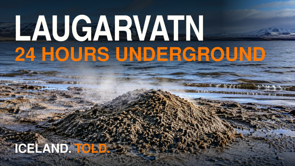
- Laugarvatn, Iceland | Hot Sand, Móberg, and Geothermal Bread (coming later): Compare Hveragerði’s acid clay boiler with the shoreline boiling sands that baptized the Vikings in 1000 AD.