THE STORY
Contents
- Brúarfoss, Iceland: Why the River Is Electric Blue, Who Broke the Stone Bridge in 1602, and the Bishop Drowned in a Sack
- Why You Could Never Simply Wade the Brúará
- Three Steps Up the Blue Woods Ladder
- 1602: The Famine Moat, and the Stone Arch Still Hiding Under the Foam
- 1433: The Stockfish Chieftains, the Maid’s Key, and the Bishop in the Sack
- Empty Royal Carriages, Lifting Cars by Hand, and the River’s Cold Ledger
- Quick Facts: Brúarfoss & the Brúará Ladder
- Frequently Asked Questions (FAQ)
- Why is Brúarfoss waterfall so blue compared to other waterfalls in Iceland?
- Why did the steward of Skálholt destroy the natural stone bridge at Brúarfoss in 1602?
- Why was Bishop Jón Gerreksson drowned in a sack in the Brúará in 1433?
- Was Game of Thrones filmed at Brúarfoss?
- Related Episodes & Further Exploring
Brúarfoss, Iceland: Why the River Is Electric Blue, Who Broke the Stone Bridge in 1602, and the Bishop Drowned in a Sack
Stand in the middle of the wooden footbridge over the river Brúará, close your eyes for three seconds, and pay attention to the soles of your boots. Most waterfalls in Iceland announce themselves long before you see them with a high, tearing roar as a vertical sheet of water smashes onto flat stone. Brúarfoss does not roar; it gulps. A low, rhythmic tremor travels up the steel-and-timber pilings into your ankles: the mechanical thrum of an entire river folding sideways off a dark horseshoe shelf into a narrow crack in the floor, dragging huge pockets of air down into the rock with it.
When you open your eyes, that jagged volcanic slot in the Bláskógabyggð woodland of South Iceland is glowing with a shade of cyan that looks as though it belongs inside a high-voltage transformer. Every day between Laugarvatn and Geysir, hundreds of travelers walk five minutes from the west-bank car park or hike three and a half kilometers up the eastern riverbank just to point a lens at that color. Yet for the first thousand years of Icelandic history, nobody walked to Brúarfoss to look at the water. They came here because this glowing fracture was a road, and because what happened at this crossing during the famine of 1602, and downstream during the summer of 1433, turned the bluest river in the country into a political border.
Why You Could Never Simply Wade the Brúará
To understand why a bridge mattered so much here, you first have to correct the most common myth repeated in English travel guides. Dozens of websites claim that Brúarfoss gets its color from glacial meltwater pouring directly off the Langjökull ice cap. If the Brúará were a surface glacial river (jökulá) like the neighboring Hvítá a few kilometers east, it would be choked with pulverized rock flour and look like wet grey cement.
As the geologist Guðmundur Kjartansson demonstrated when he mapped this gorge in the 1940s, the Brúará is one of Iceland’s classic spring-fed rivers (lindá). High on the highland margin south of Mount Hlöðufell, rain and snowmelt sink underground and percolate for kilometers through the porous, sponge-like lava sheets of Úthlíðarhraun before emerging at 430 meters above sea level on Rótarsandur above the gully of Brúarárskörð. That subterranean lava sieve traps all the heavy volcanic sand and dark silt, discharging cold, three-to-six-degree spring water that has a low suspended sediment load.
When daylight drops into the deep central fissure at Brúarfoss, selective absorption of longer wavelengths by water contributes to the blue; scattering and the light reaching the water also influence what you see. Give that same water a pale sandy bottom and the effect would bleach out immediately; here, the river runs across a pitch-black trough of wet basalt and dark Pleistocene subglacial breccia (móberg) that absorbs stray light like an optical black box. As hundreds of thin, glassy rivulets spill inward from left, right, and center and collide head-on inside the central slot, they whip millions of microscopic white air bubbles into the scattered blue light until the trench ignites into milky electric turquoise.
Kjartansson pointed out a second consequence of that underground plumbing that mattered far more to medieval travelers than the color. A glacial river swells violently during July heatwaves and drops to a shallow trickle in October; sooner or later in autumn, a horseman can wade it. A spring-fed river buffered by a massive lava aquifer never drops low enough to wade safely and never freezes solid at the rapids in winter. Either the Brúará stops you cold, or you find a bridge.
Three Steps Up the Blue Woods Ladder
Follow the older three-and-a-half-kilometer trail upstream from Route 37 along the eastern bank, and you see how the river cuts its staircase through the remnant downy birch woodland that gave Bláskógabyggð (“Settlement of the Blue Woods”) its name. Rather than dropping over a single horizontal cliff caprock, the Brúará saws across alternating beds of soft, glassy subglacial móberg tuff and hard basalt ledges in three distinct steps known as the Brúará Ladder.
A kilometer and a half below Brúarfoss sits the bottom step, Hlauptungufoss, the Running Tongue Falls, where the entire river is rammed into a narrow, four-meter-high basalt chute that twists like a white foaming tongue. Beneath the surface, that single rock bottleneck is an evolutionary border wall. Atlantic salmon (lax) swimming up from the sea slam into the turbulent cauldron below Hlauptungufoss and cannot jump it, leaving the upper river past Miðfoss (“Middle Falls”) and Brúarfoss exclusively to resident cold-water Arctic char (bleikja) and brown trout (urriði).
Along the birch-lined banks by Miðfoss, where the river spreads across a two-meter shelf of rapids, the loud trilling song of the Icelandic wren (músarrindill), a year-round resident and the island’s second-smallest bird, cuts through the hiss of the foam. Look closely into the white water right at the lip of the chute and you may spot a slate-blue duck with bold white crescents diving straight into the hydraulic vortex. The Harlequin Duck (straumönd, “Stream Duck”) is a North American species that breeds nowhere in Europe outside Iceland. Equipped with dense down and flexible ribs built to take a beating in white water, it walks along the submerged basalt boulders at the bottom of the rapid, prying blackfly larvae off the rock face in four-degree current. And if an internet guide told you that HBO filmed Game of Thrones along this riverbank, it put you in the wrong valley: those cameras rolled thirty kilometers west at Öxarárfoss in Þingvellir. The human drama on the Brúará required no scripts from Hollywood.
1602: The Famine Moat: and the Stone Arch Still Hiding Under the Foam
Look closely at the older Icelandic name of the waterfall, Brúarárfoss, the Waterfall of the Bridge River, and the grammar gives away the history. The crossing came first; the river was named after the crossing; the waterfall was named after the river.
Since the days of Landnámabók, when the settler Ketilbjörn the Old claimed the district between the Brúará and Tungufljót and his great-grandson Ísleifur Gissurarson founded Iceland’s first bishopric downstream at Skálholt in 1056, a natural arch of volcanic rock spanned the narrow central fissure at Brúarfoss. For five centuries, that stone bridge served as the main highland doorway into Biskupstungur.
Then came the Little Ice Age famine around the year 1602. As Provost Jón Halldórsson of Hítardalur recorded on page 190 of his Biskupasögur (written after he entered school at Skálholt in 1679, within living memory of the event), years of failed hay harvests and hardship on land and sea drove destitute, starving families from every direction toward the Lutheran cathedral estate at Skálholt, where tithes of butter, dried fish, and livestock were stored under Bishop Oddur Einarsson.
The estate steward (bryti) at Skálholt decided to solve the welfare crisis by editing the geography. Acting with the knowledge, if not the explicit advice, of the bishop’s wife, Helga Jónsdóttir, and strictly behind the back of Bishop Oddur himself, the steward marched a work crew up to Brúarfoss with iron crowbars and hammers and broke the natural stone arch down into the gorge. Overnight, the glowing cyan slot became a famine moat, stranding the hungry on the far bank. When Bishop Oddur discovered what his steward had done, he was furious and warned the man that breaking the bridge would bring misfortune on both the steward and the see. Not long afterward, the steward lost his footing while crossing the Brúará and drowned in the river he had weaponized.
What almost every English retelling leaves out is what happened after 1602, and what still lies beneath the white water today. When geologist Guðmundur Kjartansson examined Brúarfoss seven or eight times in the 1940s for his 1948 paper “Steinboginn á Brúará” in Náttúrufræðingurinn, he documented that a natural stone arch still crosses the river at the falls today, submerged roughly knee-deep beneath the breaking foam. In local Biskupstungur farm tradition, Skálholt’s men never demolished the entire arch; they simply knocked enough rock off its crown to submerge it under the fast current and make it impassable. Kjartansson himself suspected the submerged arch had always sat low in the water and that the original dry arch stood a few meters upstream, where the fissure narrows to barely one meter across.
Even more remarkable is the forgotten rebellion of 1680. Eighty years after the steward broke the crossing, the farmers of Biskupstungur grew tired of being cut off and took matters into their own hands. Led by a local blacksmith named Jón Jónsson smiður í Miklaholti, the men of the district hauled massive grey basalt boulders to the edge of Brúarfoss, rolled them into the narrowest throat of the fissure, and built a new bridge on top of them. Winter floods repeatedly tore their timber superstructures away, yet in July 1941, during an unusually dry spell, Kjartansson found a single water-worn basalt boulder weighing several hundred kilograms still wedged thirty centimeters below the waterline in the one-meter slot, and climbed across the gorge on the last surviving stone of the 1680 blacksmith’s bridge.
1433: The Stockfish Chieftains, the Maid’s Key, and the Bishop in the Sack
The Skálholt steward was not the highest-ranking church official the Brúará ever swallowed. One hundred and sixty-nine years before the stone arch was broken, in the summer of 1433, the river served as the execution chamber for Bishop Jón Gerreksson.
Born Jöns Gerekesson Lodehat around 1378 into a Danish noble family, Jón had been made Archbishop of Uppsala in Sweden by his friend King Erik of Pomerania until Pope Martin V deposed him in 1422 for violent misconduct and repeated breaches of celibacy, declaring him unfit for high prelacy. Four years later, in 1426, the same Pope relented and handed him the bishopric of Skálholt in Iceland, noting dryly in Latin that little was at stake because the diocese lay “inter gentes quasi barbaras”: among almost barbarous peoples.
As historian Gunnar Karlsson of the University of Iceland details on Vísindavefurinn, Jón Gerreksson arrived at Skálholt in 1430 with a gang of thirty armed Danish and Icelandic retainers (sveinar) and spent the next three years proving the Pope’s low standards right. Two early Icelandic chronicles preserve the twin sparks that lit the explosion. According to the sixteenth-century Gottskálksannáll, the bishop’s master steward (and reputed son), Magnús kæmeistari, tried to force a marriage on Margrét Vigfúsdóttir, daughter of the royal governor. When Margrét turned him down, Magnús rode with an armed posse to her family’s estate at Kirkjuból í Höfnum, shot her brother Ívar Vigfússon to death, and burned the farmhouse around them. Margrét escaped through a hidden passage, fled north to Eyjafjörður, and swore a solemn blood oath: she would marry no man on earth except the one who avenged her brother and rid Iceland of the bishop.
Jón Egilsson’s 1605 Biskupa-annálar adds a second, wonderfully petty humiliation. The bishop’s mercenaries had kidnapped several wealthy Icelandic chieftains, including Þorvarður Loftsson of Möðruvellir (who was in love with Margrét) and Teitur Gunnlaugsson, locked them in leg irons at Skálholt, and forced these proud aristocrats to sit on the floor beating dried stockfish (berja harðfisk), considered the most menial servant’s drudgery in the country. At Easter, the guards drank themselves unconscious and dropped the keys to the fetters. A serving maid (vinnukona) at Skálholt found the keys in the dirt, unlocked the chieftains, and let them slip into the night.
In 1433, Þorvarður Loftsson and Teitur Gunnlaugsson rode back into Skálholt at the head of a northern army. Bishop Jón fled into the cathedral in his full episcopal vestments and clung to the high altar holding the holy relics, gambling that no Christian chieftain would dare spill consecrated blood with a sword inside a church. The sanctuary did not save him; neither did the absence of a blade. The chieftains dragged the bishop out of the sanctuary, sewed him alive into a heavy linen sack, tied a boulder to the neck of the bag, and hauled him down to the Brúará by the Spóastaðir ford, where they threw him into the freezing current until he drowned. His retainers were cut down in the church, save for a handful who escaped to the coast and hijacked an English fishing vessel to flee the island, leaving behind a 1433 shipowner’s petition to the Privy Council of the King of England as the sole contemporary paper trail of the coup. True to her word, Margrét married Þorvarður, and the serving maid who found the keys in the dirt was rewarded with a twenty-hundreds estate and a rich husband.
Empty Royal Carriages, Lifting Cars by Hand, and the River’s Cold Ledger
Even after the stone arch was broken and the blacksmith’s boulders washed down the slot, the gorge at Brúarfoss refused to retire as a road. Around 1800, locals laid a narrow timber beam across just the central chasm above the falls, which Reverend Guðni “sterki” (“the Strong”) Guðmundsson of Miðdalur rebuilt with a handrail in 1824: a crossing that still terrified foreign travelers because high water submerged the planks out of sight, making it look as though their Icelandic guides were riding straight into the abyss.
In 1901, a full wooden bridge spanned the gorge of Steinbogabrúgljúfur, and in 1907 it became Kóngsbrúin, the King’s Bridge, along the newly dug Kóngsvegurinn built for the state visit of King Frederik VIII of Denmark and forty Danish parliamentarians. Supervised on the western heath by road foreman Guðjón Helgason at Laxnes (whose three-year-old son would grow up to take the farm’s name and win the Nobel Prize as Halldór Laxness), the road project required substantial funding from the Icelandic state. A light royal carriage driven by Guðmundur Hávarðarson was brought along on the assumption that a monarch would not ride a horse; Frederik VIII mounted a pony instead, and the carriage rattled across the Brúarfoss bridge completely empty.
Twenty years later, in August 1927, Egill Hallgrímsson coaxed the first automobile to Geysir across that same timber deck, though the cart track met the bridge at such a sharp right angle that his passengers had to climb out and lift the car bodily to line its wheels up with the planks. Fortified for British Army trucks during the Second World War and closed to cars in 1948, the rotting bridge claimed one last victim in 1960, when a Scottish guide leading a troop of British Boy Scouts on horseback distrusted the old planks, tried to ford the river above the waterfall, and drowned with his horse in the chasm while local horseman Gunnar Bjarnason pulled a fallen Scout from the slot. When the modern Route 37 highway bridge opened four kilometers downstream in the autumn of 1961, the ancient road past Brúarfoss died overnight, falling into such complete obscurity for the next fifty years that the local youth association (Ungmennafélag Biskupstungna) eventually had to organize a field trip just to introduce Biskupstungur’s own farmers to the waterfall on their river.
Today, as you stand on the 1966 steel-beam footbridge (re-decked in timber in 2009), that history is worth remembering before you step past a rope line for a closer selfie. Because Brúarfoss drops only two to three meters, visitors routinely mistake the Brúará for a gentle woodland stream. It is a fast, four-degree hydraulic trap lined with black basalt and móberg shelves polished slick by floodwater and coated in wet algae and winter ice. In 2022, a father drowned at Miðfoss after jumping in to push his fallen son back to the bank; in 2024 and again on June 6, 2025, visitors slipped into the basalt chute at Hlauptungufoss and did not come out alive. Once you go into four-degree white water, cold shock strips your muscles of strength in seconds. Stay on the bridge and the marked trail.
Feel the timber humming beneath your boots one last time. Down in the black volcanic slot, just above the submerged stone arch whose connection to the crossing broken in 1602 remains disputed, hundreds of clear, lava-filtered rivulets fold inward from both banks, colliding in a spiral of white air and electric cyan before the crack swallows the river in a single, unhurried gulp.
A STORY. NOT A GUIDE.
ICELAND. TOLD.
Quick Facts: Brúarfoss & the Brúará Ladder
| Feature / Metric | Verified Specification |
|---|---|
| Location & Municipality | Brúarfoss / Brúarárfoss, Bláskógabyggð Municipality, South Iceland (64.2642, -20.5158) |
| River & Source Hydrology | Brúará (~40 km spring-fed river / lindá, rising at 430 m a.s.l. on Rótarsandur south of Mt. Hlöðufell after filtration through Úthlíðarhraun lava) |
| The Brúará Ladder (3 Steps) | 1. Hlauptungufoss (2–4 m basalt chute, 1.5 km downstream; salmon barrier) · 2. Miðfoss (~2 m rapid shelf, 1.0 km downstream) · 3. Brúarfoss (2–3 m inward horseshoe fissure) |
| Optical Mechanism | Lava-sieved spring water free of glacial rock flour; selective light absorption and scattering, a dark basalt/hyaloclastite bed, and entrained white-water bubbles |
| Key Historical Dates | 1433: Danish Bishop Jón Gerreksson sewn into a sack and drowned in the Brúará · 1602: Skálholt steward breaks the natural stone arch during famine · 1680: Blacksmith Jón Jónsson at Miklaholt builds boulder bridge · 1901 / 1907: Kóngsbrúin built for King Frederik VIII · 1961 / 1966: Highway moves downstream; current footbridge erected |
| Signature Wildlife | Harlequin Duck (Histrionicus histrionicus, straumönd), Icelandic Wren (músarrindill), Arctic char (bleikja), brown trout (urriði) |
| Access & Parking | Short Walk (Opened April 2023): West-bank paid car park · Full Trail: East-bank hike from Route 37 (3.5 km each way / 7.0 km round trip, 2–3 hours) |
Frequently Asked Questions (FAQ)
Why is Brúarfoss waterfall so blue compared to other waterfalls in Iceland?
Unlike muddy glacial rivers such as the nearby Hvítá, the Brúará is a crystal-clear spring-fed river (lindá) whose water percolates through kilometers of porous lava (Úthlíðarhraun and Rótarsandur), filtering out heavy sand and grey rock flour. When that pure water pours into Brúarfoss’s deep, pitch-black volcanic fissure, the water selectively absorbs longer wavelengths, while its depth, dark bed, lighting, and entrained air bubbles influence the cyan and turquoise appearance.
Why did the steward of Skálholt destroy the natural stone bridge at Brúarfoss in 1602?
According to Provost Jón Halldórsson’s Biskupasögur (p. 190), during a severe famine around 1602, destitute and starving people flocked across the natural stone arch at Brúarfoss toward the wealthy Lutheran cathedral estate of Skálholt. Acting with the knowledge of the bishop’s wife, Helga Jónsdóttir, but without the knowledge of Bishop Oddur Einarsson, the estate steward took a work crew to the river and broke down the stone arch to stop the hungry crowds from reaching Skálholt. The steward drowned in the Brúará shortly afterward.
Why was Bishop Jón Gerreksson drowned in a sack in the Brúará in 1433?
Jón Gerreksson (Jöns Gerekesson), a deposed former Archbishop of Uppsala appointed Bishop of Skálholt in 1426, terrorized Iceland with thirty armed retainers, humiliating chieftains Þorvarður Loftsson and Teitur Gunnlaugsson in chains and burning the farm of Kirkjuból, where his steward Magnús killed Ívar Vigfússon. Fulfilling the blood oath of Ívar’s sister Margrét Vigfúsdóttir in 1433, the chieftains dragged the bishop from the Skálholt altar, sewed him alive into a stone-weighted sack, and drowned him in the Brúará.
Was Game of Thrones filmed at Brúarfoss?
No. Despite widespread claims on travel blogs, neither Game of Thrones nor the Bollywood film Dilwale was filmed at Brúarfoss. The Game of Thrones Season 4 waterfall and canyon scenes were filmed roughly 30 kilometers west at Öxarárfoss in Þingvellir National Park.
Related Episodes & Further Exploring
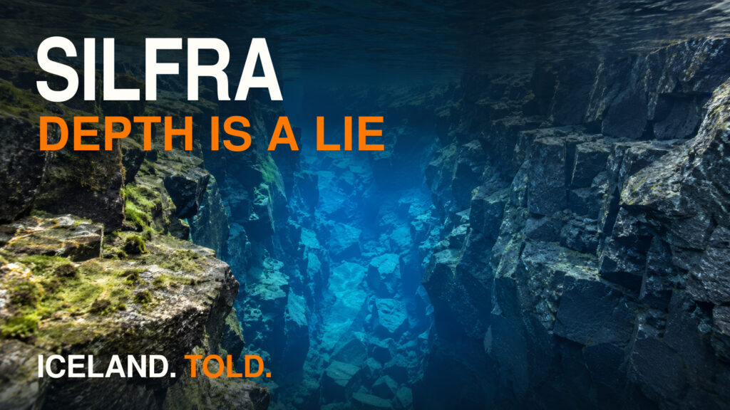
- Silfra: The Clearest Water on Earth and the Cold Price: Follow another underground lava filtration system where highland meltwater spends decades inside porous basalt before emerging into a tectonic fissure at Þingvellir.
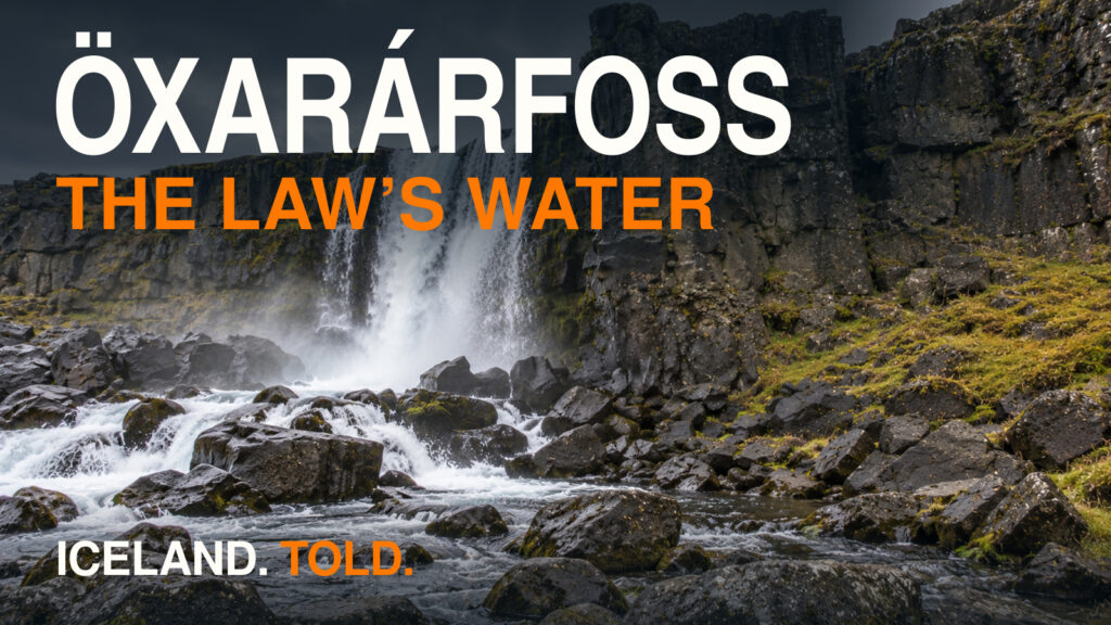
- Öxarárfoss & Drekkingarhylur: The Waterfall Built by Parliament and the Drowning Pool: Visit the actual Game of Thrones waterfall in Þingvellir, where judicial drownings were carried out under the 1564 Stóridómur law code.
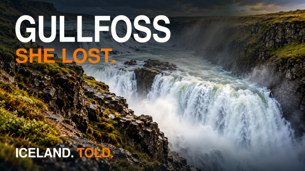
- Gullfoss: The Royal Road, the Farmer’s Daughter, and the Undercut Gorge: Continue east along the 1907 Kóngsvegurinn (King’s Road) to see where King Frederik VIII’s cavalcade rode after crossing the Brúará.