THE STORY
Contents
- The Fence, the Ghost Ship, and the Beatle Town: What You Miss When You Treat Keflavík as Just a Runway
- Quick Facts: Reykjanesbær (Keflavík, Njarðvík, Hafnir & Ásbrú)
- The Chain-Link Time Machine: When "Little America" Leaked Rock 'n' Roll Across the Lava
- Two Buildings and the Cost of Crossing an Ocean
- Walrus Ivory Before 874 AD and the Ghost Ship That Built a Church
- Trawler Sparks, One Hundred Model Boats, and the Giantess Under the Cliff
- Frequently Asked Questions (FAQ): Visiting Keflavík & Reykjanesbær
- Is Keflavík the same place as Reykjavík?
- What is the difference between Keflavík, Njarðvík, Hafnir, and Reykjanesbær?
- Can I visit the Íslendingur Viking ship right after landing on an early morning flight?
- Where can I see the anchor and timber of the 1881 Jamestown ghost ship?
- Related Iceland Explained Episodes
The Fence, the Ghost Ship, and the Beatle Town: What You Miss When You Treat Keflavík as Just a Runway
Companion piece to the video episode: Keflavík, Njarðvík, Hafnir & Ásbrú (Reykjanesbær)
Look at the destination on your flight booking the next time you fly to Iceland: Reykjavík. Then check the three-letter code on the luggage tag looped around your suitcase handle: KEF. The name sells you the capital; the code sends you somewhere else.
Walk through the sliding glass doors of the arrival terminal and your nose immediately corrects the airline industry. You are not in Reykjavík; the capital's cafés and colored tin roofs sit fifty kilometers to the northeast. You are standing fifty meters above sea level on the exposed basalt plateau of Miðnesheiði (63.9850, -22.6056), on the outer tip of the Reykjanes Peninsula, beside the coastal communities of Reykjanesbær (Visit Reykjanes).
Within three seconds of leaving the terminal building, the weather introduces itself horizontally. Rain on Miðnesheiði rarely bothers with gravity; pushed by low-pressure fronts rolling unobstructed off the Irminger Sea, it flies parallel to the asphalt, finding the gap between your collar and your throat while you fumble with a rental-car key fob. And if you inhale deeply through your nose, you catch the signature three-part chemical chord of Iceland's real front door: the sweet, oily exhaust of Jet A-1 aviation kerosene drifting off the runways, a faint subterranean thread of hydrogen sulfide (H2S) leaking from the peninsula's geothermal fissure swarms, and the heavy, unmistakable protein roast of capelin and cod meal (fiskimjöl) boiling down at the harbor plants.
Most travelers load their bags into a trunk, merge onto the four-lane asphalt ribbon of Reykjanesbraut (Route 41), and floor the accelerator toward Reykjavík without once looking in the rearview mirror. In doing so, they skip the single most honest cross-section of modern Iceland. While the tourism brochures sell you an imaginary country of elves, unspoiled waterfalls, and Viking chieftains, the four distinct communities of Reykjanesbær, Keflavík, Njarðvík, Hafnir, and the former American military enclave of Ásbrú, hold the machinery that actually dragged Iceland from a damp turf-house colony into the twenty-first century (Lume Travel: Reykjanesbær Guide).
Quick Facts: Reykjanesbær (Keflavík, Njarðvík, Hafnir & Ásbrú)
| Attribute | Verified Field Data |
|---|---|
| Municipality & Formation | Reykjanesbær (/ˈreiːcaˌnɛsˌpaiːr/, "Smoke-Peninsula Town"), formed in 1994 by merging Keflavík, Njarðvík, and Hafnir (Lume Travel). |
| Region & Tectonic Setting | Suðurnes (Reykjanes Peninsula UNESCO Global Geopark); direct landfall of the Mid-Atlantic Ridge (~2 cm/year plate divergence) (Visit Reykjanes). |
| Primary Coordinates | Keflavík Harbor (Duushús): 64.0058, -22.5553 | Njarðvík (Víkingaheimar): 63.9708, -22.5236 | Hafnir (Kirkjuvogur): 63.9346, -22.6873 | Ásbrú: 63.9744, -22.5792 |
| Key Historical Dates | ~770–880 AD (Hafnir early seasonal cabin) | June 1881 (Stranding of American timber clipper Jamestown) | 1951–2006 (US Naval Air Station Keflavík / NASKEF) | 1963 (Formation of Hljómar, birth of Bítlabærinn). |
| Signature Cultural Anchors | Víkingaheimar (Íslendingur Gokstad ship replica), Stekkjarkot turf fishermen's cottage (1855–1924), Duushús & Grímur Karlsson's 100+ boat models, Skessuhellir Giantess Cave, Rokksafn Íslands, and the Njarðvík Shipyard (Lume Travel). |
| Geological & Ecological Features | Jagged apalhraun (ʻAʻā) and smooth helluhraun (pāhoehoe) basalt flows, zero surface rivers (porous basalt aquifer lens), Racomitrium moss cushions, and Hafnaberg sea cliffs (63.8756, -22.7314, nesting northern fulmars). |
| Distance from KEF Terminal | 5 to 15 minutes by car along Routes 41, 44, and 45 (50 km southwest of Reykjavík). |
The Chain-Link Time Machine: When "Little America" Leaked Rock 'n' Roll Across the Lava
To understand why Keflavík feels different from every other coastal town in Iceland, you have to drive up to the flat plateau of Ásbrú (63.9744, -22.5792) just south of the runways and look at the street layout (Visit Reykjanes). Even before anyone tells you its history, your eyes register something subtly foreign. The roads curve in wide, mid-century American suburban arcs. The concrete apartment blocks have flat roofs, wide utility corridors, and heavy steel doors built to military specifications. Step inside an older unrenovated stairwell and you will still spot rectangular vertical wall plates stamped for 110-volt, 60-hertz American electrical outlets in a country that runs on 230-volt European current.
From 1951 until September 30, 2006, this plateau was Naval Air Station Keflavík (NASKEF): known to every Icelander simply as Vellirnir ("The Fields") and inhabited by thousands of American soldiers, airmen, sailors, and their dependents whom locals called Kaninn ("The Yank").
In the 1950s and 1960s, the high chain-link fence surrounding the Keflavík base was arguably the sharpest cultural border in Western Europe. Outside the wire lay a young, cash-poor North Atlantic republic where rural migrants still remembered turf houses, imported consumer goods were throttled by strict currency rationing, and beer stronger than 2.25% alcohol was completely illegal (a prohibition that lasted until March 1, 1989). Inside the wire sat "Little America": a neon-lit enclave with bowling alleys, high-school cheerleaders, suburban ranch houses, PX commissaries stacked with peanut butter, Hershey bars, and Lucky Strikes, and clubs serving ice-cold American lager.
The politicians and cultural gatekeepers in Reykjavík were terrified of the base. They worried that a nation of fewer than 200,000 people could lose its language and bloodline overnight if young Icelandic women mingled with wealthy American troops. So the state erected legal barricades: strict curfews, humiliating gate-pass checks for Icelandic civilians working inside the fence, a notorious diplomatic demand that barred the US military from stationing Black service members in Iceland for decades, and eventually restrictions on the base's television signal, after households beyond the fence began watching American Armed Forces Television.
What the authorities in Reykjavík could not arrest at the gate was the electromagnetic spectrum.
Twenty-four hours a day, Armed Forces Radio (AFRTS) pumped Chuck Berry, Elvis Presley, Little Richard, Buddy Holly, and later the Beatles and the Rolling Stones straight through the chain-link fence into the bedrooms of working-class teenagers in Keflavík and Njarðvík (Lume Travel). Young locals who worked as mechanics, carpenters, and warehouse clerks on the base bought second-hand Fender Stratocasters, Gibson hollow-bodies, tube amplifiers, and stacks of freshly pressed 45-rpm vinyl records from departing American airmen months before those sounds ever reached record shops in Reykjavík.
In 1963, while much of rural Iceland was still listening to accordion waltzes and male choir harmonies, a group of teenagers in Keflavík led by guitarist Gunnar Þórðarson and bassist-vocalist Rúnar Júlíusson plugged in their instruments and formed Hljómar (The Chords) (Lume Travel). They wrote original songs in Icelandic with four-part Merseybeat harmonies and overdriven guitars, turning Keflavík overnight into Bítlabærinn: "Beatle Town." Walk through Rokksafn Íslands (The Icelandic Museum of Rock 'n' Roll, 63.9822, -22.5606) today and you trace an unbroken electrical circuit running from that Cold War fence through Hljómar and 1970s supergroup Trúbrot all the way to 1990s rap-rock trailblazers Quarashi and indie-folk phenomenon Of Monsters and Men (Lume Travel).
And when the US military finally packed up its P-3 Orion patrol planes and handed back the keys on a rainy morning in September 2006, the town refused to become a Cold War ghost town. Renamed Ásbrú after the mythological rainbow bridge of the Norse gods, the former barracks became student and family apartments, while massive aircraft Hangar 885 was soundproofed into Atlantic Studios, where Hollywood and British crews filmed George Clooney's arctic sci-fi drama The Midnight Sky, and HBO's True Detective: Night Country, which used the sodium-orange winter streetlamps and trawler piers of Keflavík and Njarðvík to stand in for the long polar night of northern Alaska.
Two Buildings and the Cost of Crossing an Ocean
Drive five minutes east from Ásbrú down to the shoreline of Njarðvík, where the bay named after Njörður, the Old Norse god of wind and sea wealth, meets the jagged lava flats of Fitjar (Lume Travel). Two buildings stand barely five hundred meters apart, but their materials tell a story that stretches far beyond the bay: timber, imported or salvaged, could carry people across an ocean; turf, stone, and whatever fuel a household could gather had to make life possible once they stayed.
Start inside the soaring glass-and-concrete wedge of Víkingaheimar (Viking World, 63.9708, -22.5236), designed by architect Guðmundur Jónsson (Lume Travel). Suspended above the floor so you can walk directly underneath her keel is the Íslendingur ("The Icelander"): a 22.5-meter, 18-ton clinker-built oak replica of the ninth-century Gokstad ship excavated in Norway.
Between 1994 and 1996, local shipwright and sea captain Gunnar Marel Eggertsson built this vessel using eighteen tons of oak and pine, five thousand hand-forged iron rivets, and pine tar, following traditional clinker-built hull geometry. In the summer of 2000, to mark the millennium of Leifur Eiríksson's landfall in North America, Gunnar Marel and a crew of eight sailed the open-decked Íslendingur out of Reykjavík, across the pack-ice currents of Greenland, down to L'Anse aux Meadows in Newfoundland, and straight into New York Harbor (Lume Travel). Stand under the bow and inhale the warm scent of linseed oil, tarred hemp rope, and curved oak planks, and it is easy to buy into the heroic nationalist romance: Icelanders as fearless Norse argonauts, masters of the North Atlantic horizon.
Now walk out the glass doors of Víkingaheimar, turn left along the salt grass of Fitjar for five minutes, and duck your head through the low wooden doorframe of Stekkjarkot (63.9722, -22.5325) (Lume Travel).
Built in stages between 1855 and 1917 and inhabited until 1924, Stekkjarkot is a reconstructed þurrabúð: literally a "dry-booth," the traditional home of a landless coastal fisherman who owned no pasture for cows or sheep and had to survive entirely on what he could pull out of the winter sea on a handline (Lume Travel; Minjastofnun Íslands).
The distance between the two buildings is short. The distance between their materials reaches across the Atlantic. Woodland loss and the lack of tall native oak forests made timber for ships like the Íslendingur a scarce, imported resource. For more than six hundred years under Norwegian and Danish rule, most coastal families lived far from the world of ocean-going ships. While foreign warships and merchantmen controlled the trade lanes, men in Njarðvík and Keflavík rowed out into the February surf in open, undecked wooden rowboats (sexæringar and áttæringar), dressed in stiff sheepskins rubbed with rancid fish-liver oil (lýsi), pulling heavy oars until their palms bled into their wool mittens.
When they came ashore soaked in freezing brine, they crawled into cottages like Stekkjarkot. Because Reykjanes has almost no surface rivers, every drop of rain sinks instantly through the porous, fractured apalhraun and helluhraun lava to float as a thin lens atop the seawater below, families drank slightly brackish water drawn from shallow tidal wells (brunnar) dug in the coastal basalt. With little firewood besides precious Siberian driftwood (kefli, which gave Keflavík its name), they heated their damp stone-and-turf rooms by burning dried sheep dung (tað), dried seaweed, and cod backbones.
Between the ship's imported timber and the cottage's turf lies a practical question: what could a household obtain, and what could it afford to burn, build, or replace? On this coast, the answer might arrive as driftwood after a storm, as water drawn from a shallow well, or, as Hafnir was about to discover, as an entire ship no one had ordered.
Walrus Ivory Before 874 AD and the Ghost Ship That Built a Church
If you follow Route 44 and Route 425 southwest from Njarðvík across the gray cushions of Racomitrium woolly fringe-moss toward the open Atlantic coast, you reach Hafnir (63.9346, -22.6873): today a quiet scatter of houses facing the western surf, once one of the busiest seasonal landing places on the peninsula (Lume Travel).
For generations, every Icelandic schoolchild memorized a single foundational date: 874 AD, the year Ingólfur Arnarson threw his high-seat pillars overboard and established the first permanent homestead in Reykjavík. Then archaeologists led by Bjarni F. Einarsson excavated an overgrown mound along Vogata in Hafnir (63.9346, -22.6873) and sliced through the unmistakable volcanic ash marker known as the Landnám tephra layer, which fell across southwest Iceland from a twin eruption around 871±2 AD (Lume Travel).
The turf cabin yielded radiocarbon dates spanning 770–880 AD, prompting an interpretation of activity before the traditional settlement date. That range is a clue, not a timestamp proving every stage of occupation ended before 871.
Why would men build a seasonal turf camp on a wind-lashed, riverless lava coast decades before farmers arrived with cattle? One proposed answer lies in the old medieval name for this coastline: Rosmhvalanes: "Walrus Peninsula." Before humans hunted them to local extinction, thousands of Atlantic walruses (Odobenus rosmarus) hauled out onto the low basalt shelves around Hafnir, Garður, and Sandgerði. To ninth-century Scandinavian hunters, a walrus beach was an open-air gold mine: its tusks yielded high-grade ivory (rostungstennur) prized across Carolingian and Anglo-Saxon Europe, and its thick hide, sliced spirally into long thongs, twisted into the strongest ship-rigging cables (svörður) in the northern world. Long before Reykjavík had a name, the shoreline of Reykjanesbær was an extractive resource frontier.
A millennium later, on June 26, 1881, the North Atlantic threw a completely different treasure onto the rocks at Hafnir (Lume Travel; Hvalsneskirkja Monograph).
Locals looking out through the Atlantic spray off Kirkjuvogur watched a massive, three-masted American full-rigged sailing ship, the 2,000-ton clipper Jamestown, built in Richmond, Maine, drive straight onto the coastal reef with tattered sails and not a single human being on deck. Months earlier, while bound from Boston to Liverpool, the Jamestown had lost her rudder in a hurricane-force Atlantic storm, and her captain and crew had abandoned ship onto a passing vessel, leaving the hull to drift hundreds of miles north on the Irminger Current.
When the fishermen of Hafnir, Keflavík, and Hvalsnes boarded the stranded ghost ship, they pried open the cargo hatches and stared in disbelief. On a treeless volcanic peninsula where families lived in rotting turf huts and waited years for Danish merchants to ship a few overpriced spruce planks, the Jamestown was packed from keel to deck beams with hundreds of thousands of board feet of prime, seasoned American hardwood and pine timber (Hvalsneskirkja Monograph).
The salvage auction changed the face of the peninsula. For generations afterward, families across Reykjanesbær boasted that their floorboards, roof rafters, and wall paneling were built of "Jamestown-timbur." In Hafnir, outside Kirkjuvogskirkja (63.9346, -22.6873), the ship's massive, salt-pitted iron anchor still rests on the grass as a monument to the day the ocean delivered a forest (Lume Travel). And ten minutes up the coast at Hvalsneskirkja (63.9886, -22.7358, consecrated in 1887), local craftsmen built the outer walls from hand-cut gray basalt blocks and fashioned the entire warm timber interior, pews, gallery, and pulpit, out of salvaged Jamestown lumber (Amazing Iceland: Hvalsneskirkja; Hvalsneskirkja Monograph). Inside that church lies the 1649 basalt gravestone of four-year-old Steinunn Hallgrímsdóttir, carved by her grief-stricken father, the impoverished pastor and poet Hallgrímur Pétursson, years before he composed the Passíusálmar (Hymns of the Passion) that carried Icelanders through centuries of cold and loss (Amazing Iceland).
Trawler Sparks, One Hundred Model Boats, and the Giantess Under the Cliff
The timber did not end the coast's dependence on ships. Along the waterfront linking Njarðvík and Keflavík, vessels still need to be hauled out, repaired, and sent back into the Atlantic; elsewhere, smaller versions of the fleet sit behind glass.
Walk past the slipways of the Njarðvík Shipyard (Skipasmíðastöð Njarðvíkur, 63.9765, -22.5480), where multi-ton steel stern trawlers sit high and dry on iron rail cradles. There is nothing curated here for tourists: just the blue-white crackle of welding torches stitching new steel plates onto ice-scarred bows, the deafening hiss of hydro-blasters stripping Atlantic barnacles off hulls, and the sharp chemical bite of red anti-fouling primer mixing with low-tide bladderwrack.
Follow the shoreline north to the old merchant point of Keflavík at Duushús (Duus Museum, 64.0058, -22.5553), where Danish merchant Hans P. Duus built his timber storehouse Bryggjuhús in 1877 to salt and export local cod (Lume Travel; Minjastofnun Íslands). Inside the long wooden hall of Bátasalur Gríms Karlssonar, retired ship captain Grímur Karlsson spent decades building more than one hundred intricate scale models of Icelandic fishing vessels (Lume Travel). Walk down the rows of glass cases and you watch a country engineer its way out of starvation: from open six-oared wooden rowboats to two-masted decked schooners (skútur), coal-fired British-built sidewinder steam trawlers, and the diesel-powered steel factories that turned a colony of tenant oarsmen into one of the wealthiest maritime nations on Earth.
Then step outside Duushús onto the seaside footpath of Bakkavegur and walk fifty meters into the shadow of the black basalt cliff (64.0058, -22.5553). Here, tucked into a natural cavern above the breaking waves, is Skessuhellir: the Cave of the Giantess (Lume Travel).
Created in 2008 with children's writer and composer Herdís Egilsdóttir, the cave is home to a life-sized, animatronic mountain troll woman (Skessan í fjallinu) who sits in her rocking chair beside an oversized patchwork bed and kitchen table, breathing heavily, snoring, and occasionally letting out a deep, rumbling burp while the North Atlantic surf slams against the rocks outside (Lume Travel). To an outsider, putting a mechanical giantess next to a serious maritime museum looks eccentric. To anyone who grew up in Iceland, it makes complete sense. When you live on a treeless tectonic rift where the wind blows horizontally, fulmars spit orange stomach oil from the crumbling 41-meter sea cliffs of Hafnaberg (63.8756, -22.7314), and the earth periodically cracks open to pour molten basalt across your roads, you either go mad with dread or you turn the dark cliff into a neighbor you can visit with your children (Visit Reykjanes).
At Sundmiðstöð Keflavíkur, the town has another kind of gathering place: the geothermal hot pot. Its conversation belongs to the people who live here, with municipal business, gossip, and the weather sharing the water. The airport moves passengers through Reykjanesbær; places like this belong to the hours between flights, when the town carries on with its own business.
A STORY. NOT A GUIDE.
ICELAND. TOLD.
Frequently Asked Questions (FAQ): Visiting Keflavík & Reykjanesbær
Is Keflavík the same place as Reykjavík?
No. REK is a metropolitan search code, while KEF identifies Keflavík International Airport. The airport (63.9850, -22.6056) is on the Miðnesheiði plateau, roughly 50 kilometers (45 minutes by car) southwest of downtown Reykjavík (Visit Reykjanes).
What is the difference between Keflavík, Njarðvík, Hafnir, and Reykjanesbær?
Reykjanesbær ("Smoke-Peninsula Town") is the unified municipality created in 1994 when the neighboring coastal towns of Keflavík ("Driftwood Bay") and Njarðvík ("Njörður's Bay") merged with the historic western fishing village of Hafnir ("Harbors") (Lume Travel). Ásbrú is the fourth distinct district of the municipality, encompassing the former US/NATO military base (NASKEF, 1951–2006) above Njarðvík and Keflavík.
Can I visit the Íslendingur Viking ship right after landing on an early morning flight?
Check the day's opening hours first: an early flight does not guarantee access. Víkingaheimar (Viking World) at Víkingabraut 1 in Njarðvík (63.9708, -22.5236), which houses Gunnar Marel Eggertsson's 22.5-meter Gokstad ship replica Íslendingur and the adjacent 19th-century turf cottage Stekkjarkot (63.9722, -22.5325), is located just 7 minutes from the KEF arrival terminal (Lume Travel). Combine it with Duushús and Skessuhellir (64.0058, -22.5553) at Keflavík harbor for an easy 2-to-3-hour loop before checking into a Reykjavík hotel or catching an afternoon departure flight.
Where can I see the anchor and timber of the 1881 Jamestown ghost ship?
The massive rusted iron anchor of the unmanned American three-masted timber clipper Jamestown, which drifted ashore at Hafnir on June 26, 1881, sits on display outside Kirkjuvogskirkja in Hafnir (63.9346, -22.6873), near the archaeological site of the early seasonal cabin at Vogata (Lume Travel). To see the salvaged American timber inside a standing building, drive 10 minutes north along the coast to Hvalsneskirkja (63.9886, -22.7358, consecrated in 1887), whose interior woodwork and pews were milled from the Jamestown's cargo (Amazing Iceland; Hvalsneskirkja Monograph).
Related Iceland Explained Episodes
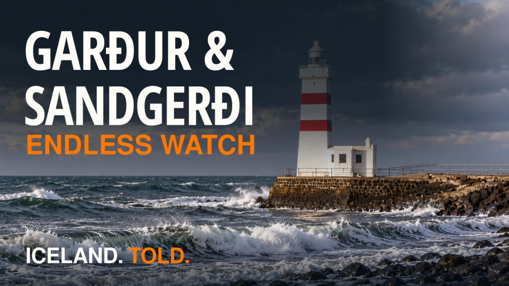
- Suðurnesjabær (Garður & Sandgerði): The northern tip of the peninsula, where the 1897 Old Garðskagi Lighthouse stands inches from tide-pool erosion and the 1928 trawler Jón forseti shattered the myth of coastal safety.
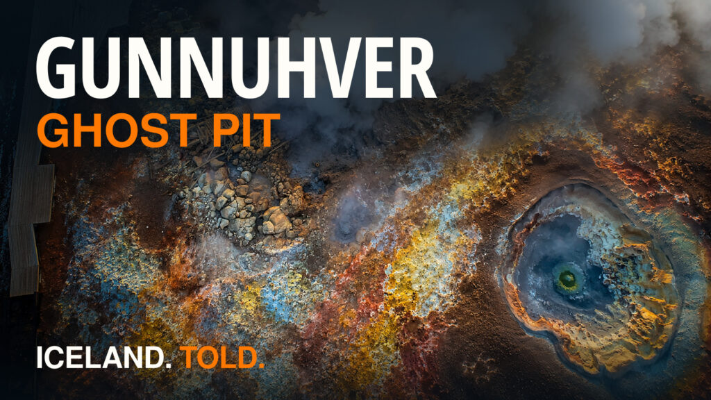
- Gunnuhver, Reykjanesviti & the Bridge Between Continents: Driving south from Hafnir past the Hafnaberg fulmar cliffs (63.8756, -22.7314) and the Pláneturnar solar-system walk (63.8167, -22.6833) into the steam-vent landscape of the Mid-Atlantic Ridge, above a seawater reservoir hotter than 300°C.
- Grindavík & the Sundhnúkur Fires: How the southern neighbor of Reykjanesbær confronted the reopening of the peninsula's volcanic fissure swarms after 800 years of quiet.